Sunday, September 8, 2013

Maryland Heights (MD)


On September 8, we braved a “sunny and 80s” forecast with our third trip to Harpers Ferry, this time to hike up the popular trail to Maryland Heights. The town of Harpers Ferry dates from the 1790s and has a very rich history (Civil War and pre-Civil War) in an exceptionally scenic setting where the Shenandoah River spills into the Potomac. An old railroad bridge over the latter (now part of the Appalachian Trail) and high cliffs above offer dramatic views and it was time we got us some. We rolled into town mid-morning and rambled a bit before heading across the bridge, briefly along the C&O Canal, and up the steep trail to the Heights.


23. Maryland Heights: The trail climbs steadily, passing historic gun placements where canons up to 5 tons were hauled up the mountain by Union soldiers to defend the area from incursions by the South. The biggest guns could lob a 100-pound slug more than two miles. But after being turned away once, the Confederates succeeded in routing the Yanks and many were killed, with thousands taken captive. There is too much history to pretend to summarize here, but Harpers Ferry was very much in the thick of it, essentially located on the line between the North and South. Plus, there’s the great story of John Brown who, shortly before the war, was determined to end slavery with a rag-tag mini-infantry under the cover of darkness, if only he could. I highly recommend the recent book, Midnight Rising, by Tony Horwitz, as not only a gripping biography of Mr. Brown, but a wonderful lead-up to the inevitability of a Civil War.

A spur path led us down to the overlook atop the cliff with the million-dollar view of Harpers Ferry. From there, it was another steady gain to the ridge top and easier ground leading to the remains of a stone fort and the gentle summit of Maryland Heights. Three states, interestingly, converge near Harpers Ferry. We’d left DC in the morning, drove through Virginia, landed in West Virginia and hiked sweatily into Maryland. On the return, the river demanded we stop and soak our feet a spell. Next time, we’ll remember the sandals since the river is quite wadable, though the gravel bottom is tough to walk on with dainty feet like mine. However, large flat rocks do lay just yards off the bank, passing time till some lazy hikers come out to sit on them. Flocks of tubes and rafts also drifted by. That’s a kind of lazy we’re going to have to get penciled in on the calendar before these 80-degree, late-summer days are all used up.
Miles (RT):  6.0 miles; elevation gain: 1,600 feet
Cumulative mileage and gain:  107.5 miles / 30,450 feet


A lizard hides in plain sight.

The stone fort.

Kris bags the summit.


The mighty Potomac.


Thursday, September 5, 2013

Blackrock Summit and Hogsback Mountain (VA)

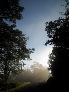
Morning at camp.

We picked up our camp at Shenandoah's Loft Mountain on Labor Day, and not missing a beat, headed for the camp store for some morning joe. A ranger was leading a talk-and-walk a few miles away to Blackrock Summit, which sounded like a mountain top to me. We scooted over to the trailhead to get our minds prepared for another itty-bitty mountain climb. Yeah, pretty easy, but still nursing a sore knee, I’ll take what I can get.


21. Blackrock Summit:  The ranger pointed out a prescribed fire area, where the Park Service had intentionally burned the forest on one side of the trail in 2008 to mimic the ecological benefits of natural fire. He stopped again to show us a small American chestnut tree. All but extinct, these once wide-ranging, giant, nut-producing trees were dominant in Shenandoah and across much of the Appalachians. Tree trunks up to ten feet across were not uncommon. Instead of looking out at a sea of oaks, hickory, locust and other trees we’re more familiar with today, Americans over a century ago were marveling at great stands of giant trees rivaling even the large, old-growth conifers of the Pacific Northwest. As in the NW, the big trees were also decimated by logging throughout much of their range.
When Asian chestnuts were introduced, they brought a disease, chestnut blight, to which the American trees had no natural resistance. They died off by the millions, decade by decade, until nearly all disappeared. The roots often remain alive underground and frequently send up new shoots, but the blight sets in after a few years and the young trees quickly die off. Genetic monkeying has produced trees that are 94 percent native and six percent Asian, which apparently provides for some resistance to the blight, but the Park Service has been reluctant to plant the genetically modified trees at Shenandoah in order to preserve natural forest conditions. It’s very hard to imagine what the forest would have looked like with these behemoths peppering the landscape.
 
American chestnut.

The ranger led us up to the summit area, a large rock pile created by freeze-thaw cycles cycling endlessly. A large talus field extended across the upper slopes and a good distance below the trail. The ranger warned of rattlesnakes that lived in the rocks. Unfazed, a mom and two young rock scramblers, aged 5 and 6, headed for the summit, with Kris and I struggling to keep up. All enjoyed the clambering and no one saw a snake. The view was most excellent.


At the summit.


We returned to the car, headed north on Skyline Drive for the next little summit, and sure enough, spotted a rattlesnake slithering across the road in front of us—our first sighting of the timber rattler I’d been looking forward to running into for the past two years. It was a-okay by me seeing this one on the road instead of in the rockpile. S/he moved somewhat awkwardly, a snake with a limp, I figured, and we wondered if it had been injured by a passing car. It seemed to strain to reach the grassy shoulder then laid there awhile keeping still with its head up. I dared not to move in too close for a portrait.
Miles (RT):  1.0 mile; elevation gain: 200 feet
Cumulative mileage and gain:  97.5 miles / 28,450 feet


Big Meadow Lodge. We'll have to stay here sometime...

And bask by the window...

Or the fireplace...

Or hang with the bears.

 
22. Hogsback Mountain:  This little wooded bump hardly gets a mention. I’d mistaken it for something else I thought would make a nice easy walk-up. The top is all radio towers and buildings and no views, an anticlimactic way to end a fun couple of days. But we were there and it’s September already, so darn tootin’ I’ll take credit here for summit number 22. There were a few nice spots along the way, so it wasn’t a total loss, plus we got to add a praying mantis to our East Coast wildlife sightings list. The mini-trek also put me over the 100-mile mark to date in attaining my sixty summits. But good grief, it’s September already and I’ve got 38 to go. Hmmm.
Miles (RT):  4.0 miles; elevation gain: 400 feet
Cumulative mileage and gain:  101.5 miles / 28,850 feet

Just below the top.


Cold Mountain (VA)


Our Labor Day getaway for 2013 was back to the Blue Ridge, this time down south a bit to Cold Mountain south of Charlottesville for Day One, and up to Shenandoah for Day Two. Cold Mountain is reportedly one of the more scenic hikes in Virginia. It promised an easy summit that seemed reasonably baggable despite my ailing, but recovering left knee, and despite scattered thunderstorms in the forecast. Kris and I grabbed a bagel and coffee over on Wisconsin Ave and hit the highway. We were at the trailhead around 1:00 pm (Sept 1).


20. Cold Mountain:  Clouds threatened, so I suggested we reverse the planned 6-mile loop so that we would hit the summit early in case the sky unloaded on us. We followed the AT gently upward in forest and soon entered the first of several grassy meadows, the second being very large with expansive views. Minutes later and before we’d left this meadow, the rain started and thunder began to boom from a couple ridges over. It looked like we were only catching the edge of it, so after a brief wait under a tree, we got a break and went for the top, not even an hour from the car. The third big opening held the summit rock, appropriately festooned with an old USGS marker. We snapped photos as the rain began again and the clouds grew more ominous. Descending the trail along a ridge, we regained the forest, where we hunkered down awhile in the moderately rainy rainstorm waiting for it to pass. We weren’t too disappointed that the lightning strikes kept their distance. When the next break came, we continued our descent to an outcrop that offered a good lunch spot. The sun reappeared right on schedule and we were soon steaming ourselves dry again while gobbling cheese sandwiches.

The improving weather suggested we skip the loop hike altogether and retrace our steps so that we could savor the views on top that we had to skip through while being pelted by rain. So we ambled back, slow and savory, finally reaching the car around 5:00pm. We headed up the Blue Ridge Parkway close by, and a couple hours later—after sighting our second black bear out east (crossing the road in front of us)—we rolled into the Loft Mountain Campground in Shenandoah, just before dark. Lucky us, there were plenty of holiday campsites remaining, probably due to the rain.
Miles (RT):  4.4 miles; elevation gain: 700 feet
Cumulative mileage and gain:  96.5 miles / 28,250 feet


The rain stops.


The not-so-precipitous summit.