 |
| Dragontail Peak. Witches Tower is just over the pass. |
At least a couple of my Summits of Sixty, I’ve pledged, must
involve the use of a rope—and not for tying the beach chairs and beer cooler to
the roof of the car. Yes, I’ve wanted to enjoy a couple of technical, though
not too harrowing, treks (perhaps several?) this year involving passage over actual
rock and/or ice, for the pure recreation of it.
In mid-August , as I made my
way back to the Northwest for a week of fun, family and projects, my friend,
Peter, of Bellingham, had already planned a five-day assault (nobody really
assaults mountains) of Mount Challenger in the Picket Range with two
of my old climbing buddies, Keith and Kiko. My timing was off by a day. Another
friend was also busy with some other fun thing, so it was looking like I could
be doing my climbing solo. Alas, the weather forecast turned slightly wet and
Challenger was sadly (for Peter) and happily (for me) postponed. But
resourceful Peter still had a free weekend and an instant plan B that fit both my
schedule and my mountain inspiration perfectly: an easy, two-pitch rock route
up the backside of Witches Tower in the Enchantment Lakes basin near sunny Leavenworth.
The hardest part would be getting there.
Because the Enchantments are gorgeous, they are popular and
at risk of being loved to death, and for that, overnight visits require much
advance planning for a chance at a permit. We, of course, had no permit. Our
only legal option was to make a long day of it—a 14-mile roundtrip hike gaining
and losing 5,400 feet. At 30, even 40, I’d've called it a piece o’ cake. At 50 and
over, I'll call it, well, invigorating. It also entailed a four-hour drive from
Bellingham.
19. Witches Tower: Peter, Kiko and I (Keith smartly opted
out) left the burger joint in Leavenworth after dark on August 17 and drove up
the Icicle Creek Road to the trailhead. A lumpy flat in the woods would have to
do for an unofficial camp. After a lumpy sleep on sticks and roots, we broke
away at dawn and had the first four miles and 2,000 feet of gain under our
belts by eight-something a.m. We enjoyed a breakfast stop, so to speak, on the
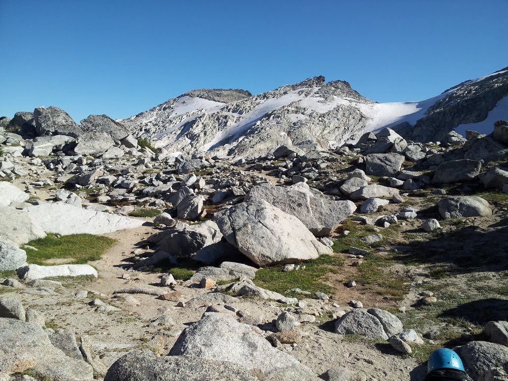
rocks at Colchuck Lake, well inside the Alpine Lakes Wilderness. Dragontail
Peak, which I also hoped to summit that day, loomed majestically above. Witches
Tower remained hidden behind it.
 |
| Breakfast. |
We rambled around the lake and over a boulder field to begin
the steep, 2,200-foot infamous trudge to Aasgard Pass. It was a veritable goat
trail. As I rounded a bushy bend in the steep and scrabbly path, a nanny and
kid mountain goat stood ten yards ahead of me posing for a picture. Cool. I
took my time heading up from there so as to preserve some energy for the climb
of the Tower and, of course, the equally lengthy return to the car that would
follow. I was also a little worried about my left knee, this particular body
part having ached on and off for months and only recently feeling semi-normal
again.
 |
| On the goat trail. |
 |
| Colchuck Lake. |

 |
| Little Annapurna from Aasgard Pass. |
By 11:30 we reached the pass—and blue-sky views of the upper
basin, the Tower, surrounding peaks and the pudgy dot of a lake now lying far below
us. I shouldn’t be so descriptive. Most Cascade climbers would find all this to
be a fairly straight-forward approach to a basic little rock climb. But
compared to the Blue Ridge in Virginia, I felt chipper enough to be in the
Alps. Beyond a tiny high lake, a steep, firm snowfield demanded ice axes, which
we retrieved and stabbed into the slope with verve. We were soon at the col
immediately behind our objective. We’d gained 5,000 feet over the course of the
morning—a good test of my east coast legs. I felt great.
|
| Witches Tower on the left. |
 |
| Our route was more or less up the center. |
From here, Kiko scurried up a class 3 scramble route on the south face of Witches Tower, while Peter and I contemplated where to begin the roped route up the West Buttress. In no time at all, Kiko was hooting from above, waving his arms from the pointy-hat summit. Peter and I differed on our preferred lines of attack (now who actually attacks mountains?), so as he further contemplated, I scrambled up the route Kiko followed and was soon waving down at Peter as well. Perhaps I was being unfair. Here, Peter is trying to make a serious climb out of this lovely rock pile, and Kiko and I are running up and down the peak like we’re playing King o’ the Hill. Kiko wanted no part of roping up, however, and after descending, headed off to Little Annapurna and his own explorations.
When I returned to the col, Peter had scoped out a more
reasonable line of ascent and I quickly agreed to give it a go. He led it all,
mostly class 4 with a short class 5 chimney, which was plenty for me, having
not even donned a climbing harness or clipped into a spring-loaded cam for at
least three summers. And just like that, we scooted up the granite, solid and
broken into handholds and footholds in all the right places. I pushed through
the chimney, around a corner and up a little friction face and there was the
summit. The views of the Enchantment Lakes basin was stupendous (there’s a word
I’ve rarely used). Dragontail Peak was close by and the main ridge led south to
the rounded top of Little Annapurna. We collected a few hero shots, enjoyed a rest
and began the descent, which included a memorable little spot on a ledge where
you get to step across absolute nothingness. It was an easy step, though it bumped
up my pulse a couple of beats.
 |
| Peter leading the climb. |
 |
| Peter on the summit. |
 |
| The view of the Enchantment Lakes. |
Given the long upward grind from the car, the extra scramble
up the summit, and the fact that it was now 5 p.m., I knew Dragontail was out of
the running and, mildly disappointed, I let it go. The Witches Tower was enough
success for one day and now I needed to get down. The left knee had finally
come around and was beginning to complain a little about the extent of the day’s
adventure. Peter raced off to Little Annie, since he had not yet do-si-doed up
that easy summit (I’d been up there several times). While he dashed southward,
I managed a controlled slide down the hard snow using my ice axe as a rudder
and brake. I skittered back to the pass and worked my way down the rubble trail
at a careful pace. I made decent time, but knew that Peter (a veritable billy
goat himself) would eventually catch me—and that he did at the exact spot I’d
stashed a few cold beers at a tiny creek crossing that morning. Kiko, after
summiting Little Annapurna, opted to hike out the long way, a chance to trek through
more miles of high-end scenery, essentially the entire basin. He would exit via
the Snow Lakes Trail. We would pick him up later on our way back to
Leavenworth.

By the time Peter and I finished our beers, it was dark
enough for headlamps and we stumbled the final few miles to the car. He spotted
a rubber boa along the way, an intriguing, harmless and rarely seen green snake
the size of a typical garter snake, and we watched it writhe in his hand
awhile. The knee by then was not happy and the last two miles did not register well
on the fun-o-meter. The parking lot finally emerged from the darkness and we were
soon depacked and debooted and on our way to find Kiko. We reached him a bit
after 10 p.m. He’d been lying on a picnic table debating whether to call for
search and rescue. He’d left us in a potentially precarious place with no
assurance of our safety. It was nice that he was concerned. Peter had to work
the next morning, which meant four hours of driving before we could fully relax
after an ambitious day. Kiko and I let Peter sleep in the back seat of his
Prius and traded off steering duty on the endless drive home. By 2:30 a.m. we
were back in Bellingham, exhausted campers, but happy ones nonetheless. For me,
it was nineteen down and 41 to go.
Miles (RT): 14.0
miles; elevation gain: 5,400 feet
Cumulative mileage and gain:
106.1 miles / 32,950 feet
 |
| Rubber boa. |


